
Missing Kyoto, I was recently looking through all my photos from Japan (I have tonnes). I particularly miss walking to work down the Kamogawa, the river that flows through the East side of Kyoto. One of the advantages of living near such a beautiful river for a whole year is getting to see it in all seasons and weathers. If you look at the map of Kyoto, it is divided by several ribbons of blue, and each one represents some of the most beautiful scenery in the city. I am therefore writing this post to celebrate and reflect on not only the Kamogawa, but all the rivers in Kyoto. Please note that in this post I am using the suffix ‘gawa’ or ‘kawa’ 川 to mean river, so rather than writing ‘Kamo River’, I am choosing to write Kamogawa, as those are the names I am familiar with.


All the rivers in Kyoto join the Yodogawa 淀川 to the south of the city, meeting the sea in Osaka Bay. Before they reach this main river and lose their individuality, four main rivers flow through the city, each with a different character. Allow me to introduce them to you.


The giant of this group is the Katsuragawa 桂川. Slow and wide, it flows through Arashiyama in the West of Kyoto, wending it way past mountains and houses, and passing under the famous Togetsukyo Bridge (渡月橋 ‘moon-crossing bridge’) on its way to join the Yodogawa. I saw this river frequently as I took many trips to Arashiyama, a popular tourist spot, with friends. This river is particularly beautiful in twilight, with the shadows of the mountains on one side and the warm lights of Arashiyama on the other.


The Katsuragawa also stars in parts of the epic Tale of Genji, written in the 11th Century by noblewoman Murasaki Shikibu. The Tale of Genji is an extraordinary piece of writing, and though I’ve only read a little, I still recommend it to anyone interested in the ancient Japanese court and its customs, or in Japanese literature and culture as a whole. The most amusing quirk of the book, and something that nicely sums up some of the difficulties of learning Japanese, is that at the time it was written referring to people by name was considered rude, so the author refers to her characters by their station in life for men, or by the colour of their clothing for women, making it a little difficult to follow as the characters often change ‘name’. Though it is no longer rude to refer to people by name, you now can’t really say the word ‘you’ to or about someone without it being rude, so the challenges persist.

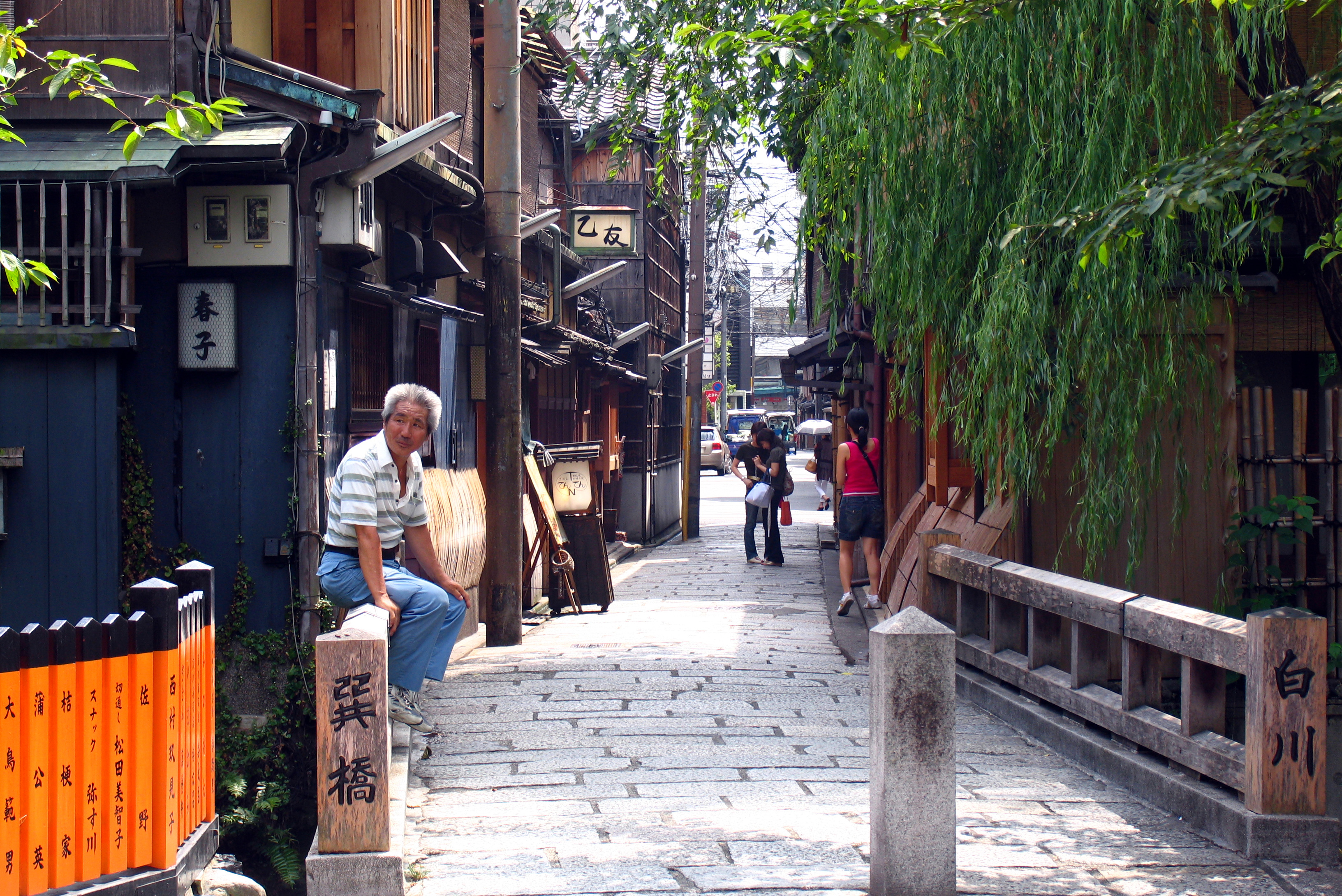
Next we have the Shirakawa 白川, literally meaning ‘white river’, named after the abundance of white sand and stones it carries through the city. It is often known as a canal in English, but there has always been a river flowing through the city under this name, it was simply diverted as part of city planning works in the 17th Century. The Shirakawa flows through Gion, one of Kyoto’s geisha districts, before joining with the Kamogawa. This river flows behind tea houses and under tiny bridges, making it very photogenic. As this is the one part of the river I apparently never took pictures of, despite going a few times, here are a couple of pictures from Wikimedia Commons, just so you know what I’m talking about.

Fortunately I do have pictures of the Shirakawa at its most photogenic – along the Philosopher’s Walk in cherry blossom season. This is the iconic cherry blossom spot of Kyoto – tourists and locals drift along the narrow river, staring up at the light pink blossoms. Out of all the days I spent in Kyoto, that day among the blossoms was the most idyllic. I must have counted at least three couples posing for wedding photos, capturing the ultimate romantic moment.


The Takasegawa 高瀬川, meaning ‘shallow river’, is another river I was very familiar with during my time in Kyoto, and one that many Kyoto inhabitants will know well, as it flows right through the city. I personally think this river is underrated – in the Spring it has beautiful cherry blossoms, and the rest of the year it provides some welcome beautification to the streets outside Kyoto’s bars and clubs in Sanjo.


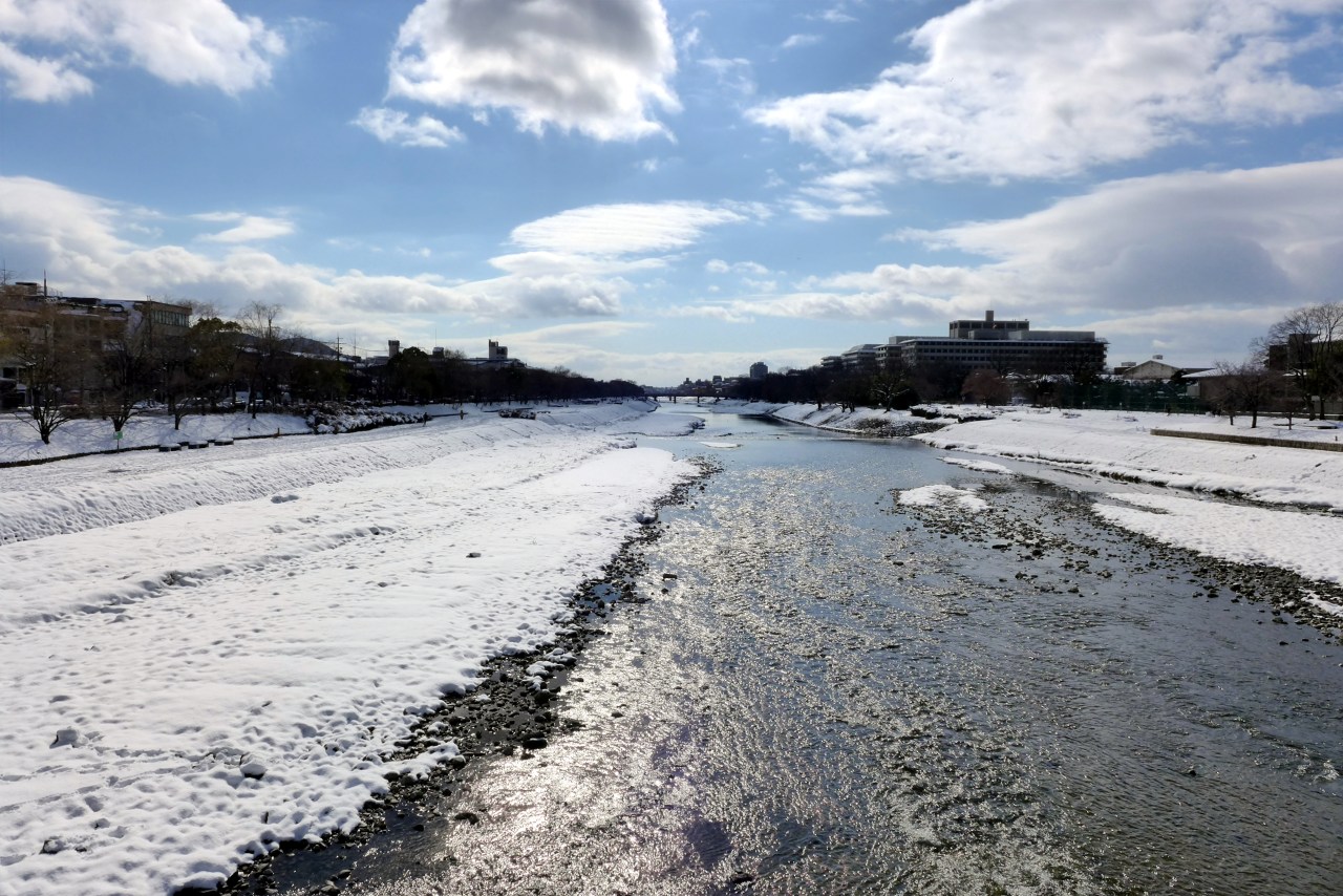
Finally we have the Kamogawa 鴨川 (meaning ‘duck river’), my favourite river in Kyoto, and not just because it was my closest. The Kamogawa has wide banks with paths and parkland running down either side, making it the perfect place for a stroll, some exercise, a bike ride, musical instrument practice, or drinking, depending on who, and when, you are. It also has turtle-shaped stepping stones, which are a fun challenge (and actually quite difficult, I’ve seen a lot of people take a dip!). The Kamogawa is also the best river for bird watching in Kyoto – kites and Crows circle above, while herons, egrets and cormorants wait for fish in the shallows.


In addition, the Kamogawa has the striking split of the Takanogawa and Kamogawa branches, two medium rivers becoming the larger Kamogawa. In the Summer this spot is popular among students to set off small fireworks and have a social drink. Though I saw it almost every day, I always thought it was a really beautiful and unique spot.


Hopefully this is the year I can be reunited with the rivers of Kyoto, but until then at least I have some great pictures and memories of them. My plan is to update this blog as and when new blog posts crop up from old memories, or I go to Japan and make new ones.


